Phugtal to Darcha
It took us another 5 days to complete our trek from Phugtal to Darcha. The highest point of the trek was Shingola (5094 mt). Kargayak was the last village before Shingola. This village at an altitude of about 4200 meters is believed to be the highest village in the Zanskar region of Himalayas.
Ascent to the base of the Shingola was pretty steep and prepared us good for the big climb to the shingola the next day. Ascent to Shingola was pretty moderate by Himalayan standards. But it is the high altitude along with cold weather and chilly winds that can act like a killer in the Zanskar.
At the end of the trek I was proud of everybody in the group as this trek was not only the test of their physical endurance but it also took the mental endurance to the next level. hmmmm ... well, I was also proud of myself for acclimatizing all the group members properly, taking care of the technical as well as logistical issues and finally leading the expedition successfully over the oh sooo high Shingola ;) ... this was for speaking modestly .... lols.
 Resting at Testa Village after a strenous half-a-day of trekking.
 Testa: Note the photovoltaic cells on rooftops of the village.
 Family at Kuru: The family we stayed with in the Kuru Village. The people of the house did not speak Hindi or English or french for that matter ;) ... so the only way we could communicate with them was through gestures.
 Prayer Flags
 Sacred Engraving of "Om Mane Padme Hung" on the Mane wall.
 Mane Wall: Budhists in this area engrave the stones with prayers and put them in a big heap, making a wall out them
 Trekking: On our way to the village of Kargayak
 Yak at Kargayak (I like the way it rhymes)
 Meeting some interesting Chzech and Tibetan people working for an NGO at Kargayak.
 Evening Beauty: We could view this peak from our room in the village.
 Morning Glory: The same peak in the morning light.
 Resting before the big ascent to the base of the Shingola.
 Ascent: To the base of Shingola
 Stream Crossing: Nat taking it easy and crossing the stream on the back of our horseman Tenzin.
 Camping at the base of Shingola.
 Resting at the end fo the day: Planning our strategy for the final ascent to Shingola in our horseman Tenzin's tent.
 Hot Tea, well deserved after a hard day of hike.
 At the base of Shingola: Pondering over the big next day.
 The Mule and the Mountain
 Star Trail @ the base camp of Shingola
 Shingola (5094 meters) : Prayer flags at Shingola. Budhist people put the prayer flags at places where there is a lot of wind due to the belief that the wind will take thier prayers to Gods.
 @ Shingola A trekker's sexy pose for my camera ;-)
 Group photo at Shingola (5094 meters): Photo that makes me feel proud of all of my group members. I feel proud of my group's endurance (Physical as well as Mental) in tackling this high altitude pass.
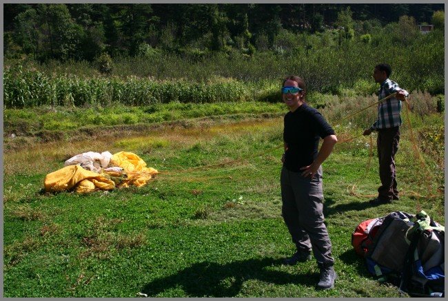
 Nathalie @ Shingola, watch the image in the funky shades.
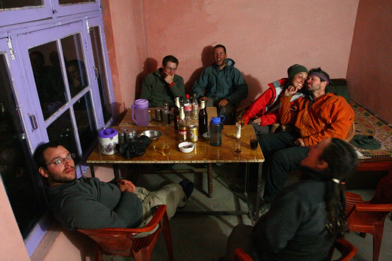
 Party at Darcha (3200 mts): Everybody was happy after finishing this 9 day trek, we celebrated the successful completion with an Old Monk (Rum from India) and some beer.
posted by Sarju at
10/23/2006 08:09:00 pm
0 Comments
![]()
![]()


